Hotline |
ICDs |
Build Status |
Build Loaded |
Wind Farms |
Mod/SW Notes |
RMT Status |
Radar Operations Center
MPDA (Multi-PRF Dealiasing Algorithm)
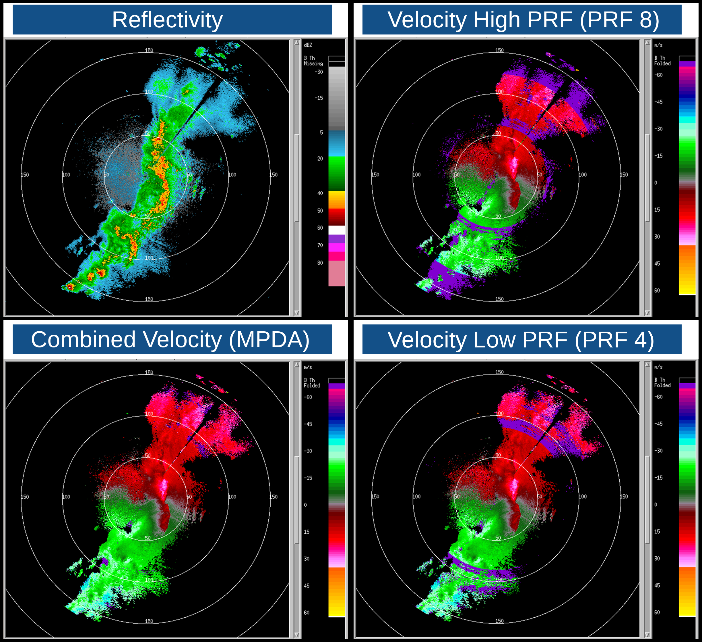
MPDA combines velocity data from a high PRF SZ-2 Doppler scan with a lower PRF SZ-2 Doppler scan to create a velocity product with reduced range folding (purple haze). VCP 112 has 3 MPDA elevations built-in by default.
Theory and Concept for Multi-PRF Dealiasing Algorithm's VCP 112 (PDF)
Add MPDA Option
The option to add 2 MPDA elevations to other SZ-2 precipitation VCPs (e.g., 212 and 215) can allow operators to have up to two MPDA elevation angles with certain scan rates for different weather environments. More details:
- For Base Tilt sites, the MPDA elevations will be the Base Tilt and 0.5°
- For non-Base Tilt sites, the MPDA elevations will be 0.5° and 0.9°
- MPDA elevations are compatible with SAILS, but not MRLE
- If MRLE is activated, MPDA scans will be deactivated and vice-versa
- Volume completion times increase by roughly 20 seconds per MPDA scan and 1 minute per MPDA SAILS scan
The images below show an example of a convective line with reflectivity (top left), the high PRF Doppler velocity (top right), the low PRF Doppler velocity (bottom right), and the resulting combination of velocity using MPDA with VCP 112 from FOP1 (KCRI Norman, OK) at 0.5° on 20180503 at 02:18 UTC.


