Hotline |
ICDs |
Build Status |
Build Loaded |
Wind Farms |
Mod/SW Notes |
MRLE (Mid-Volume Rescan of Low-Level Elevations)
The Mid-Volume Rescan of Low-Level Elevations (MRLE) function is based on the proven SAILS concept. However instead of only rescanning the lowest elevation, MRLE rescans the lowest "N" elevations (where "N" can either be 1, 2, 3, or 4 elevations). MRLE rescans the elevations in the middle (by time) of the volume scan.
General Description (PDF)
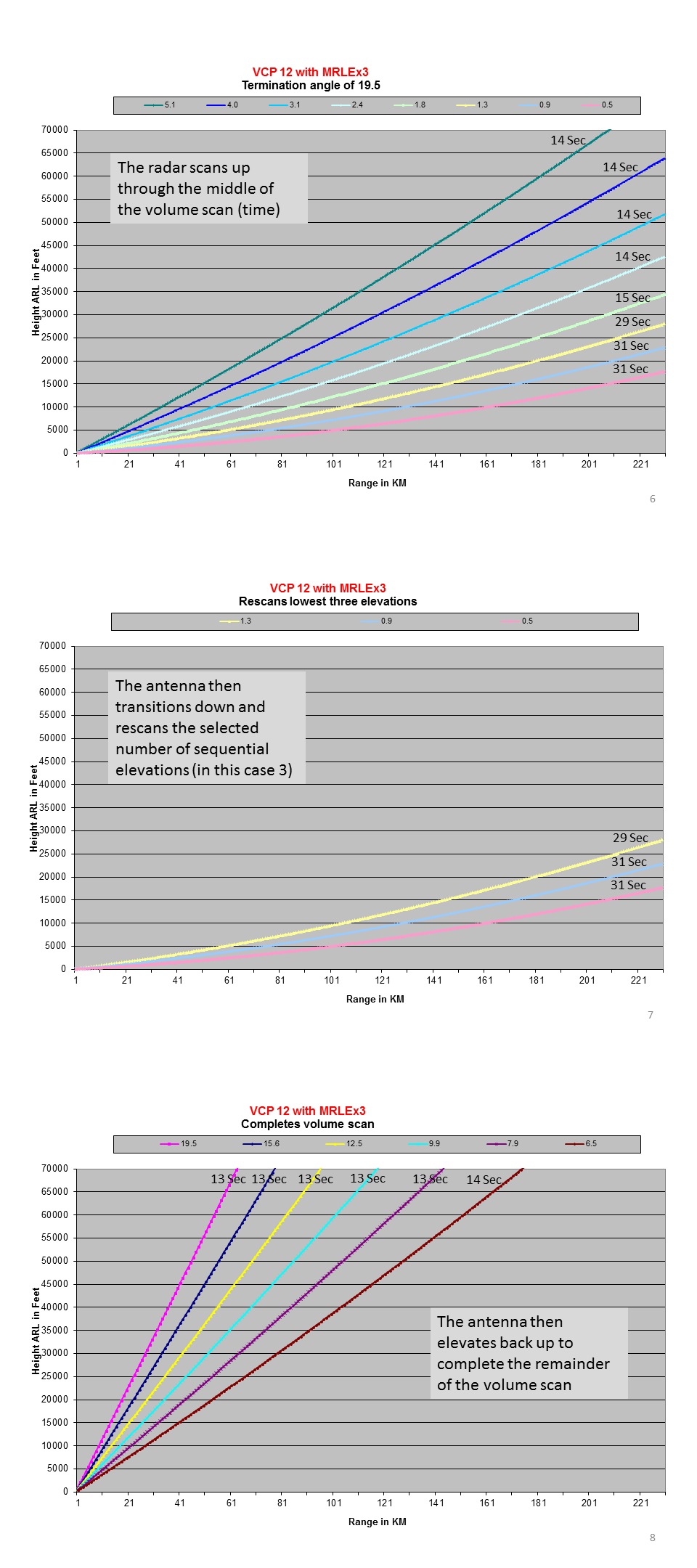
The example illustrated below shows the radar operating in VCP 12 with a termination angle of 19.5° (AVSET is off or storms are near the radar) and the operator has requested MRLE X 3. In this case from a non-Base Tilt site, the radar:
- Scans up through the middle of the volume scan based on time (5.1° here; Figure 1)
- Transitions down to collect the three supplemental angles (0.5°, 0.9°, and 1.3°; Figure 2)
- Moves up to the elevation after the middle time (6.4°) and resumes collecting the remaining volume scan angles.


