Hotline |
ICDs |
Build Status |
Build Loaded |
Wind Farms |
Mod/SW Notes |
RMT Status |
Radar Operations Center
ROC Analysis of Wind Turbine Siting Proposals
The ROC analyzes siting proposals using provided wind farm project information and radar information from a geographic perspective. This input goes into a GIS-based program, which returns potential intersection locations. Using those results, the ROC estimates the level of impact based on the number of elevation angles affected and proximity to the radar. Further details about each step can be found in the sections below.
Proposals
The ROC learns of wind farm developments through both formal and informal methods. Formally, the Department of Commerce's National Telecommunications and Information Administration (NTIA) acts as clearinghouse for developers to voluntarily submit wind farm proposals for review by several federal agencies, including NOAA. This formal process is recognized by the wind industry in the American Wind Energy Association's (AWEA) Wind Siting Handbook (AWEA 2008). Informally, the ROC occasionally receives notifications directly from developers, city planners, or learns of wind farm projects from local forecast offices who email news articles or web links to stories about planned wind farms; these are recommended to go through the formal NTIA process. The ROC tries to proactively contact the developers if a third party notifies the ROC of a wind project that has the potential to significantly impact a nearby WSR-88D. The ROC typically receives ~15 notifications per month.
Regardless of the source, two specific pieces of information are required to be able to run our analysis software:
- latitude and longitude of the individual turbine locations or the farm boundary outline points
- the total turbine height (max turbine blade tip height) Above Ground Level (AGL), which is the length of the blade plus the turbine hub height.
The following additional information is helpful for project tracking and verification:
- estimated number of turbines in the project
- turbine hub height
- turbine blade tip length
- map of the proposed project area
Relevant Radar Requirements
Our analysis software also requires the following general information for each WSR-88D:
- terrain height data
- radar coverage data
- radar tower height
- beamwidth
GIS Analysis
Both the information from the project and nearby radars are compared in a GIS program in order to assess impacted locations in the Radar Line of Sight (RLOS).

|
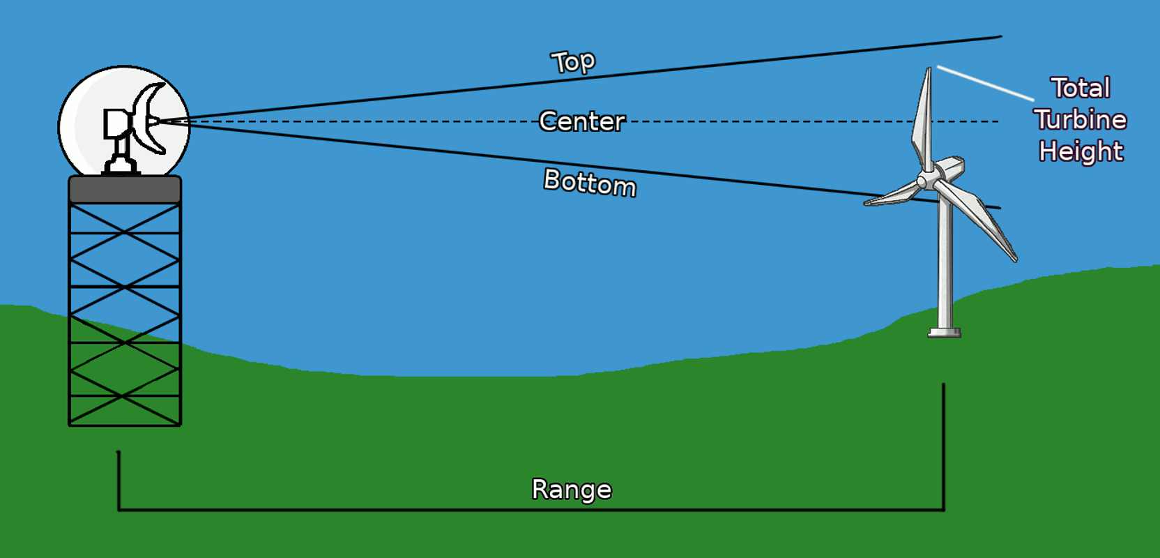
| Figure 1: Diagram representing how a wind turbine can impact the Radar Line of Sight. Currently, any percentage of intersection with any part of the beam is considered an impact. |
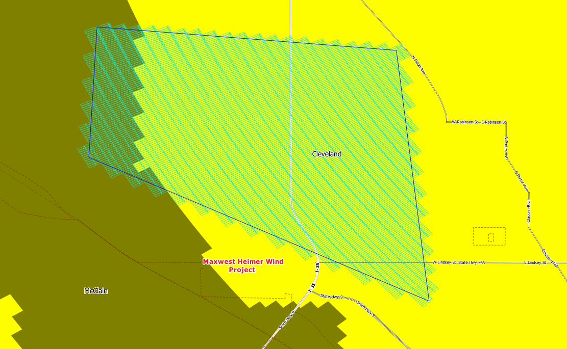
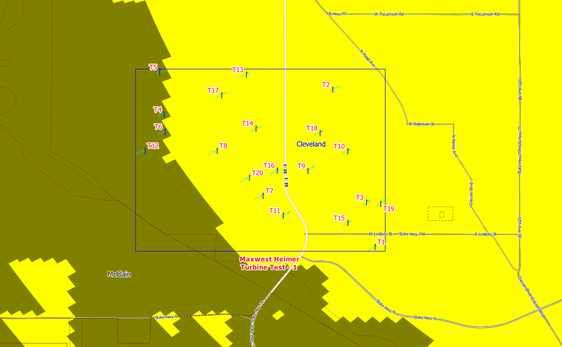
Each wind turbine location or each associated point within the area polygon is compared to the bottom-beam-height of the radar range bin at that point. If the total turbine height will intersect the bottom of the beam, then the location is flagged as an "impacted bin". All analysis results are stored in a database for future reference.

|
| Figure 2: Example of a fake boundary case with impacted bins highlighted. |

|
| Figure 3: Example of a fake turbine point case with impacted bins highlighted and potential turbine IDs labeled. |
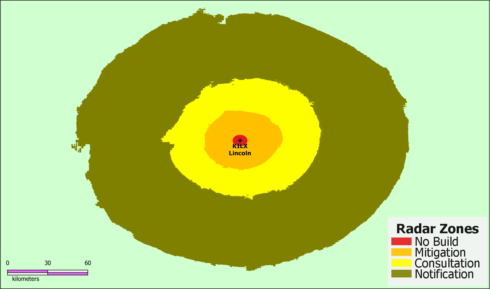
The level of impact is related to the proximity of the radar and the total number of elevation angles impacted, starting from the lowest operational angle. Four specific zones are used to help reflect the extent of impact.
ZONES:
- No Build: A red 4 km radius around the WSR-88D indicating the potential for serious impacts, including turbine nacelles blocking the radar beam and potential receiver damage if sited in the radar's near field. (Action Taken)
- Mitigation: An orange zone indicating where 3 or more elevation angles are impacted (Action Taken)
- Consultation: A yellow zone indicating where at least 2 elevation angles are impacted (Possible Action Taken)
- Notification: A green zone indicating where at least 1 elevation angle is impacted (Generally No Action Taken)

|
| Figure 4: Visual representation of impact zones around KILX for a 310 m turbine height. Structures beyond these zones are considered to be outside of the RLOS under normal conditions and would be labeled as a Neutral case. |
Actions Taken When Impacted
Projects that may have major impacts require further discussion with the ROC Subject Matter Expert for Wind Farms, the developers, local managers, and nearby Weather Forecast Offices, airports, or DOD bases. Some projects may be moved, reoriented, lowered, or not built to avoid severe impacts.
Other projects may enter into a Curtailment Agreement, which means the owner of the wind turbines will stop or change the rotating speed to < 1 rpm to avoid clutter contamination from the moving target during significant weather situations.


